UN
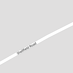
79 Shellfield Road
£ 229,500
Description
We don't have a Description for this property.
- Bedrooms
- 3
- Bathrooms
- 0


Leaflet © OpenStreetMap contributors
The heatmap indicates the level of crime in the area. The color of the heatmap indicates the crime severity and recency.
Metrics Year-on-Year
- Average area value
- 265,714.00 £Decreased by 4.26 %
- Average area rental value
- 1,082.00 £/moIncreased by 12.01 %
- Est rental Yield
- 4.89 %Increased by 16.99 %
- Crime Rate
- 0.00 %
from 277,544.00 £
from 966.00 £/mo
from 4.18 %
from 0.00 %
Nearby Schools
| Name | Type | Ofsted | Distance |
|---|---|---|---|
| Peterhouse School | Non-maintained Special School | Outstanding | 0.31 KM |
| Presfield High School And Specialist College | Community Special School | Good | 0.36 KM |
| Larkfield Primary School | Community School | Good | 0.45 KM |
| Crossens Nursery School | Local Authority Nursery School | Outstanding | 0.45 KM |
| Marshside Primary School | Community School | Requires improvement | 0.85 KM |
Images
Nearby Streets
| Name | Average Price | Average Sqft | Distance |
|---|---|---|---|
| Manx Janes Lane | £ 0 | 0 | 0.00 KM |
| Churchgate Mews | £ 0 | 0 | 0.00 KM |
| Moss Lane | £ 409,000 | 0 | 0.00 KM |
| Carisbrooke Drive | £ 0 | 0 | 0.00 KM |
| Beresford Drive | £ 295,000 | 0 | 0.00 KM |
Nearby Transport
| Name | NLC | TLC | Distance |
|---|---|---|---|
| Meols Cop | 2357 | MEC | 2.97 KM |
| Southport | 2262 | SOP | 5.07 KM |
| Birkdale | 2352 | BDL | 6.93 KM |
| Bescar Lane | 2351 | BES | 7.40 KM |
| Lytham | 2670 | LTM | 7.72 KM |
Nearby Listings
| Address | Price | Type | Score | Distance |
|---|---|---|---|---|
| Shellfield Road,Southport,PR9 9UL | £ 350,000 | BUY | 7 / 10 | 0.01 KM |
| Larkfield Lane, Southport, PR9 8NP | £ 270,000 | BUY | 7 / 10 | 0.15 KM |
| Larkfield Lane, Marshside, Southport | £ 230,000 | BUY | 6 / 10 | 0.15 KM |
| Shellfield Road, Southport, PR9 9UL | £ 160,000 | BUY | 6 / 10 | 0.16 KM |
| Larkfield Lane, Southport, Merseyside, PR9 8NP | £ 220,000 | BUY | Unknown | 0.19 KM |
Nearby Properties
| Address | Price | Distance |
|---|---|---|
| 121 Shellfield Road | £ 119,950 | 0.00 KM |
| 69 Shellfield Road | £ 212,500 | 0.00 KM |
| 73 Shellfield Road | £ 165,000 | 0.00 KM |
| 99a Shellfield Road | £ 189,000 | 0.00 KM |
| 101 Shellfield Road | £ 122,500 | 0.00 KM |